Module 3 explores Natick’s geography and includes a brief tour of Natick’s historic landmarks.

Module 3: Maps and Natick Landmarks
Module 3 explores Natick’s geography and includes a brief tour of Natick’s historic landmarks. Rachel Speyer Besancon talks about how to read a 1750 map of Natick and the steps that go into creating maps of your own. Terri Evans takes us on a tour of 10 historic landmarks that Natick’s third graders might recognize.
Making Maps
Learn why we use maps and how to orient yourself in a space using a map. Rachel Speyer Besancon teaches us how to read a map of Natick and shows us how to make our own map.
10 Landmarks in Natick
Terri Evans takes us on a tour across Natick to visit 10 landmarks you may have seen around town. Included in her tour are the Harwood Baseball Factory, Casey’s Diner, the Natick Community Organic Farm, and the Henry Wilson Shoe Shop.
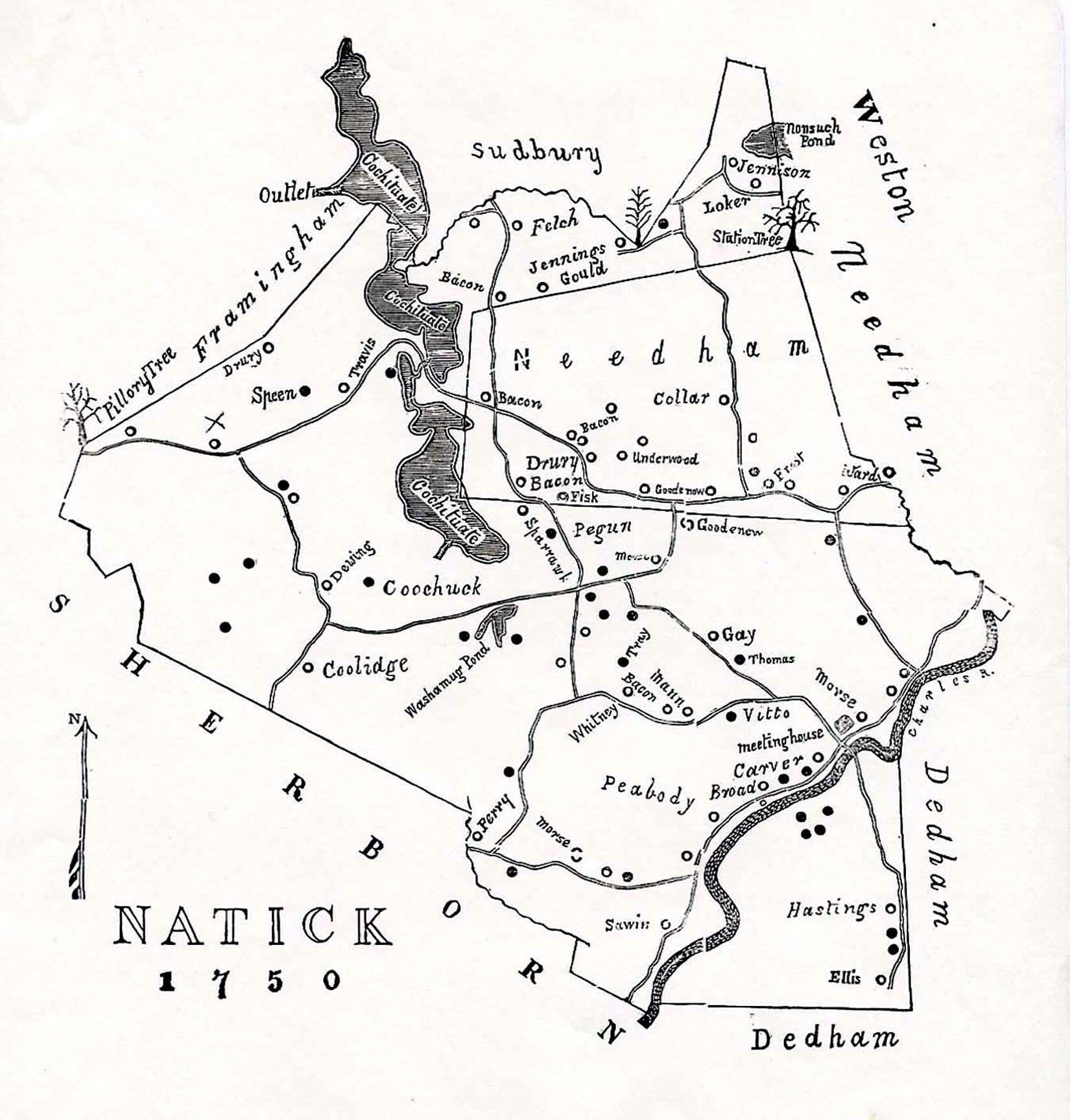
1750 Livermore Map of Natick
On this map, you can see the Station Tree in the northeast corner of town. Do you recognize any of the family names on this map?
Map of the 10 landmarks visited by Terri in video 2
Have you ever been to any of these places? Do you live near any of them? Is your school near them? Try plotting these landmarks on the map on the back of your worksheet.

On This Land Online is made possible by a grant from Mass Humanities, which provided funding through the Massachusetts Cultural Council (MCC). The Natick Historical Society would also like to thank Middlesex Savings Bank for its sponsorship and the generous private donors whose contributions brought this program to life.